Geospatial data from the growing number of commercial satellites orbiting Earth holds immense potential to provide valuable insights. However, effectively processing this massive amount of data and turning it into usable visualizations has proven challenging.
Two technology veterans aim to simplify this process with their new startup – Fused. Founders Isaac Brodsky and Sina Kashuk previously worked on mapping systems at Uber and recognize the difficulty in streamlining satellite imagery. Their previous company Unfolded.ai aimed to tackle this problem but was later acquired.
Through their experience, the founders saw an opportunity in leveraging serverless computing for geospatial data processing. serverless architectures allow automated scaling of computational resources based on demand, removing the need for manual infrastructure management.
Fused launched in 2021 with a $1 million pre-seed funding round led by Fontinalis Partners. The startup’s platform consists of three key components – data ingestion, processing via serverless APIs, and visualization tools.
Satellite data is first fed into the platform from various sources. Fused then applies user-defined processing functions through serverless APIs to extract useful insights like crop yields or weather patterns. This analysis normally takes hours but Fused completes it within seconds due to its optimized architecture.
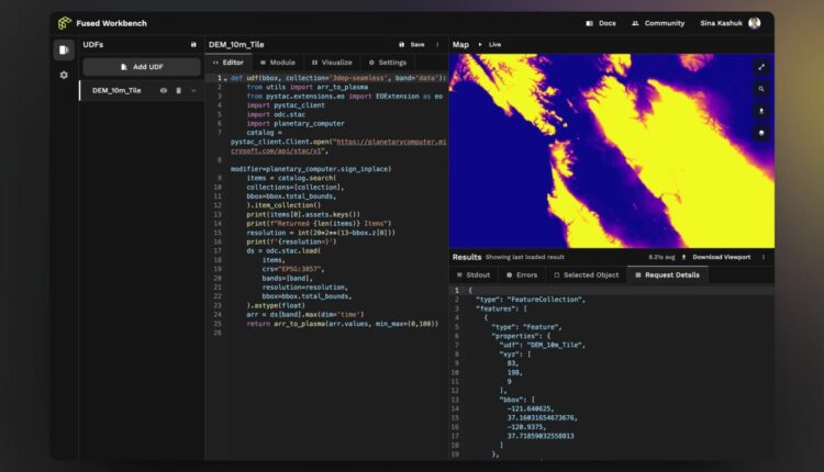
The final step involves visualizing results through the Fused Workbench. As a web-based tool, it allows interacting with processed geospatial data in real-time. Visualizations update instantly as changes are made, speeding up decision making.
By leveraging open source tools and serverless computing, Fused aims to streamline satellite imagery analysis and make spatial insights more accessible and actionable for industries like agriculture, conservation and more. If successful, it has the potential to generate new perspectives from the voluminous data being collected every day from above the Earth’s surface.


